Kauaʻi is about five million years old, the oldest of Hawaiʻi’s main inhabited islands, and it has spent most of that time being worn down by some of the heaviest rain on Earth. It was also the kingdom Kamehameha never conquered. In 1810 its king, Kaumualiʻi, joined the unified Hawaiian Kingdom by agreement instead of by war.
Captain James Cook made his first landing in the islands here, at Waimea on the west side, in January 1778. Sugar came next. In 1835 a company leased 980 acres at Kōloa from the king and paid its Hawaiian workers in paper scrip, good only at the company store. Old plantation land still shapes the island, right down to who owns the cave in this story.
The photos here are the postcard. The small print under each one is the rest of the story. Tap a numbered pin on the map to jump to that stop.
The RouteIn trip order
Kauaʻi drawn from real elevation data (AWS Terrain Tiles, built from USGS and other public sources). Contour lines every 500 feet, bold every 1,000 feet. Roads are simplified and pins are approximate. Tap a pin to jump to that stop.
Some backgroundBefore the stops
How Kauaʻi became Kauaʻi
The short version: who held the land, how it changed hands, and who kept going.
A short history of the island
About 5 million years ago
Magma from the hot spot under the Pacific Plate builds the island.
AD 200 to 1200
Polynesian voyagers arrive by double-hulled canoe. The Kauaʻi Historical Society places the first settlers between 200 and 600; charcoal and rat teeth in Makauwahi Cave (stop 9) point to about 1200 on that coast.
January 20, 1778
Captain James Cook’s ships reach the mouth of the Waimea River. They bring disease. By 1890 a Hawaiian population once estimated at 300,000 or more had fallen below 40,000. (This is Waimea on Kauaʻi, not the Big Island town or Waimea Bay on Oʻahu.)
1810
King Kaumualiʻi joins Kamehameha’s kingdom by agreement. Kauaʻi is the only island Kamehameha never took by force.
1835
Ladd & Company leases 980 acres at Kōloa for sugar and pays workers in scrip good only at its own store.
1848 and 1850
The Māhele turns land into private property, and a new law lets foreigners buy it.
1864
George Norton Wilcox takes over Grove Farm plantation near Līhuʻe, and Kamehameha V sells Niʻihau to the Sinclair family, ancestors of the Robinsons, for $10,000 in gold.
1865
The kingdom sends William Hillebrand to Asia to find plantation labor. He returns with more than 500 Chinese contract workers.
1893
American and European businessmen, backed by U.S. Marines, overthrow Queen Liliʻuokalani. In 1993 Congress formally apologizes.
1984
The first Pūnana Leo, a preschool run entirely in Hawaiian, opens in Kekaha (stop 5), when fewer than 50 children in the islands could speak the language.
September 11, 1992
Hurricane ʻIniki hits as a Category 4 storm and destroys more than 1,400 homes on the island.
2000
After 136 years with the Wilcox family, Grove Farm is sold to AOL founder Steve Case.
2009
Gay & Robinson hauls Kauaʻi’s last load of sugar cane.
2016 and 2017
Mark Zuckerberg files suits to force the sale of small family land claims inside his North Shore estate, then drops them after a public outcry.
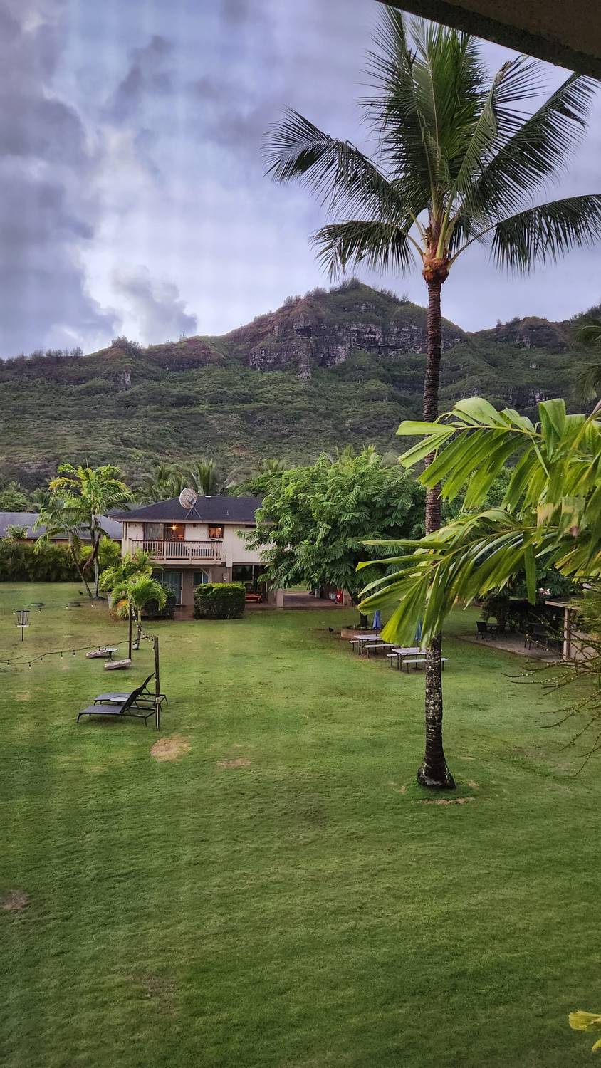
First light from the room. That jagged ridge behind the palms is Hāʻupu.
Līhuʻe grew up around sugar. Grove Farm, the plantation next door, stayed in one family for 136 years, until AOL founder Steve Case bought it in 2000.
Līhuʻe quick facts
What it is
The county seat of Kauaʻi and home to the island’s main airport, so almost every trip starts here.
The ridge
Hāʻupu, 2,297 feet, the highest named peak in the small range on the island’s southeast side. You can see it from Līhuʻe on one side and Poʻipū on the other.
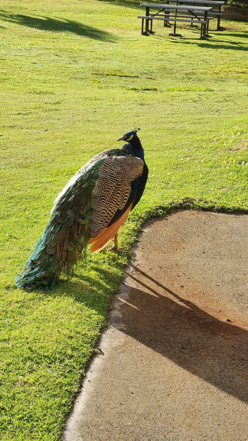
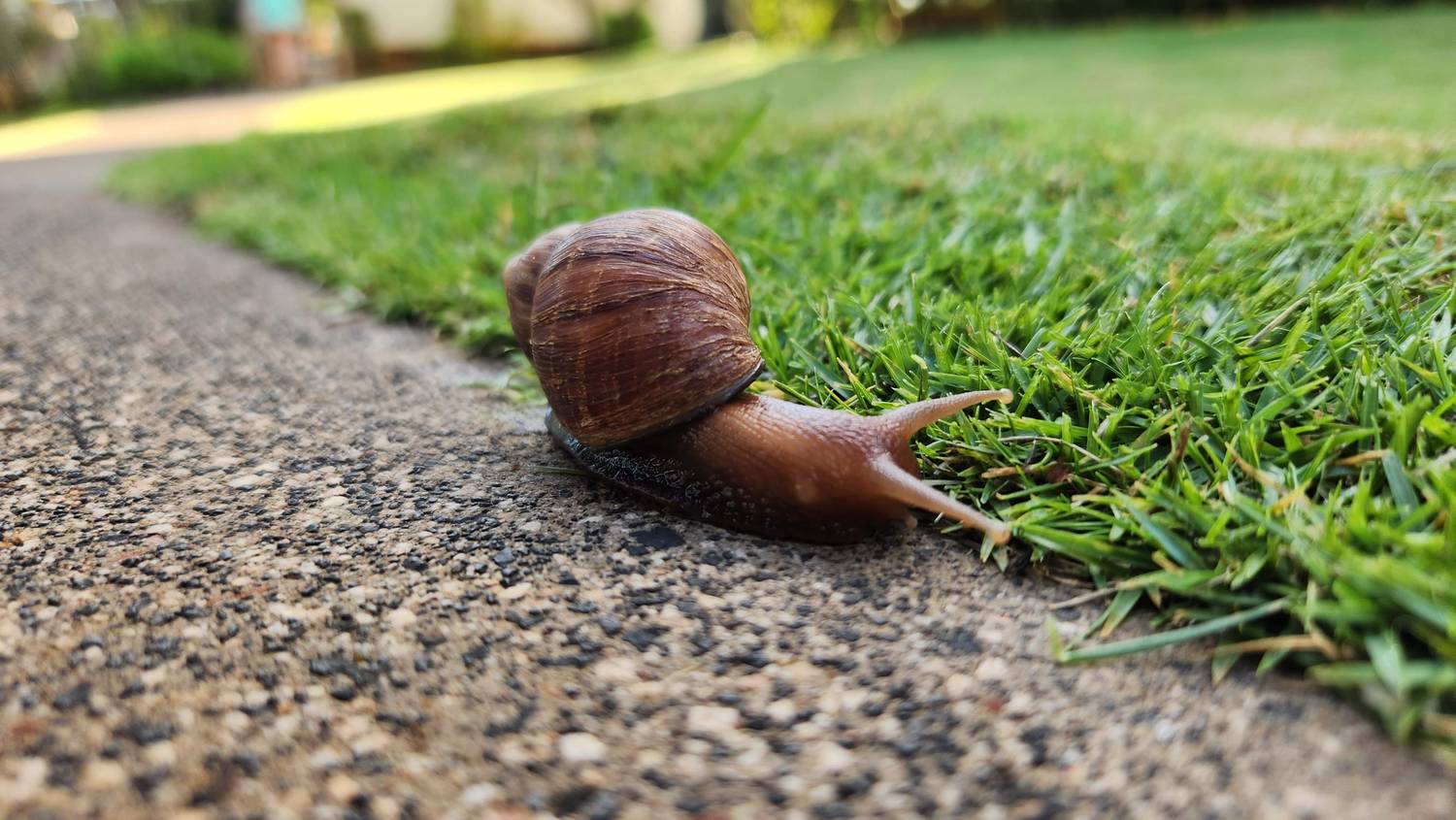
Right behind the peacock, crossing the sidewalk at snail speed. I got down on the ground for this one.
What it most likely is
Giant African snail
It looks like one: the largest land snail in Hawaiʻi. Someone brought them to Oʻahu in 1936 as garden pets, and they were first reported on Kauaʻi in 1958.
Why it matters
An invasive pest that eats garden plants and crops.
Look, don’t touch
Snails and slugs in Hawaiʻi can carry rat lungworm, a parasite that can make people seriously ill. Don’t pick them up, and wash produce well.
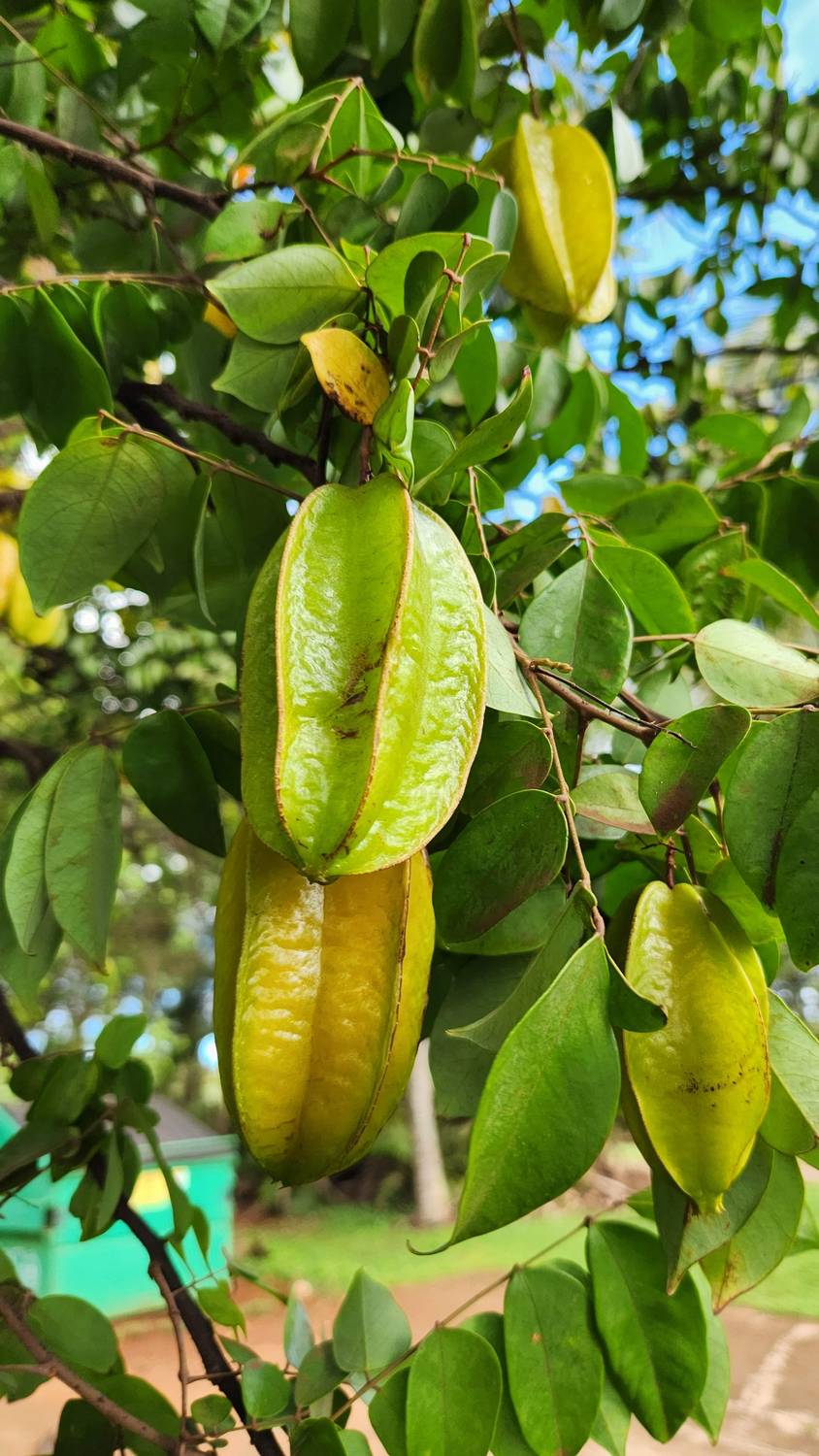
The Moloaʻa Sunrise Fruit Stand, on Kūhiō Highway on the way up to the North Shore, with a starfruit tree loaded with fruit right next to it. I got the Taste of Kauaʻi: very nice and very tropical. Some of the best coffee of all my travels came from this stand, too.
Just up the coast at Pilaʻa, Mark Zuckerberg bought a 700-acre estate in 2014. In 2016 he sued hundreds of descendants of the Hawaiian families who held small kuleana plots inside it, to force a sale. After the outcry, he dropped the suits and wrote, “it’s clear we made a mistake.”
Starfruit and coffee
Starfruit
Carambola. Chinese sandalwood traders brought it to Hawaiʻi from southern China. Slice it crosswise and every piece is a star.
Season
In Hawaiʻi the trees fruit from about September through April, so late October is prime time.
The stand
On the ocean side of Kūhiō Highway at Koʻolau Road, between mile markers 16 and 17.
Coffee up here
North Shore coffee is a real thing. Moloaʻa Bay Coffee has grown coffee and cacao above Moloaʻa Bay since 1998, on about 4,000 hand-picked trees.
Coffee down south
Kauai Coffee Company in Kalāheo is the largest coffee grower in the United States: about 4 million trees on 3,100 acres of what used to be McBryde sugar land.
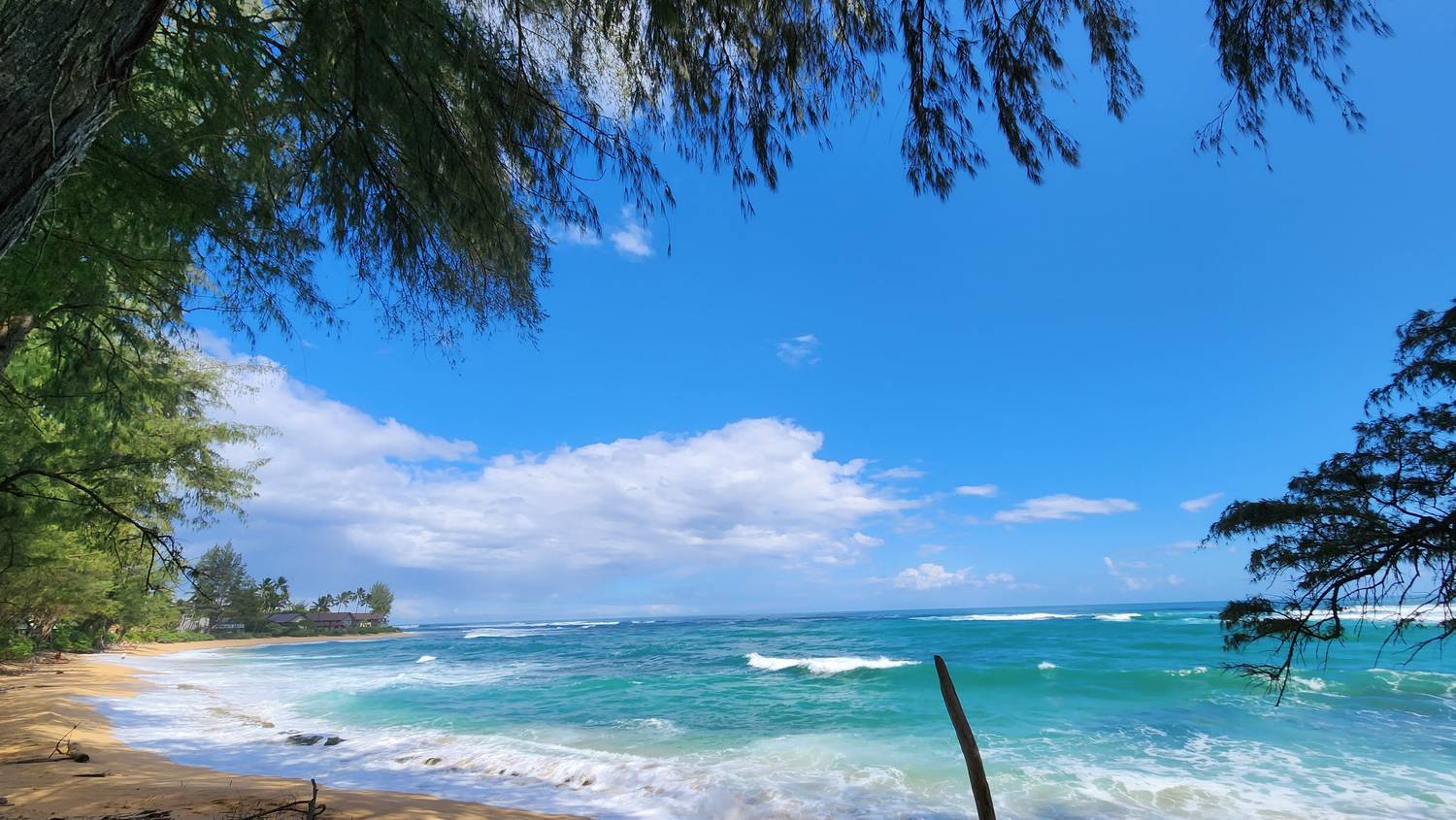
Framed by ironwoods, with the water doing three shades of blue at once. The ultrawide lens was made for this.
Lumahaʻi Beach quick facts
Where
Along Kūhiō Highway, west of Hanalei and before Hāʻena.
On film
The 1958 movie South Pacific shot here. It’s the beach where Mitzi Gaynor sings “I’m Gonna Wash That Man Right Outa My Hair.”
Look, don’t swim
There’s no reef to break the waves, so they hit steep sand with heavy shorebreak and strong rip currents. People have drowned here. It’s a beach for looking at.
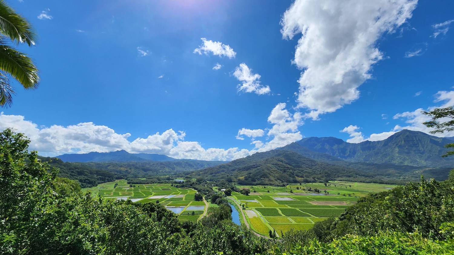
That patchwork on the valley floor is taro, grown in flooded fields fed by hand-dug ditches off the Hanalei River, the way it has been done here for centuries.
Hanalei National Wildlife Refuge
Established
1972, the oldest of Kauaʻi’s three wildlife refuges.
Taro
The refuge alone grows more than 40 percent of all the taro in Hawaiʻi. Taro is poi, and since 2025 it’s the official state plant.
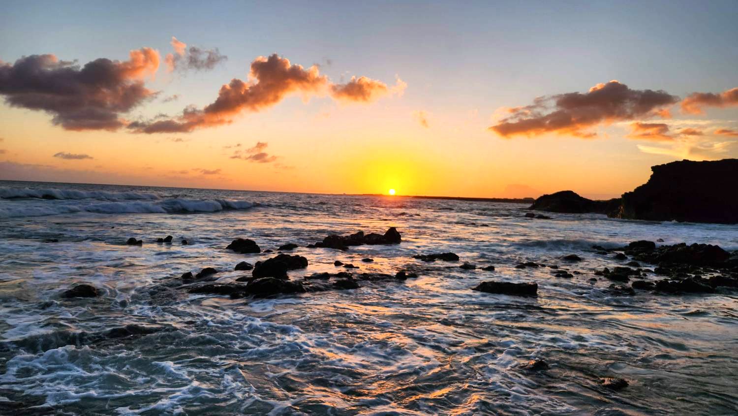
The far west side at sunset. Somebody had driven right out onto the sand to watch it.
Up the beach is the Navy’s Pacific Missile Range Facility, the largest instrumented missile range in the world. The family that owns Niʻihau has done at least $25 million in business with the Navy.
Kekaha and the view west
On the horizon
Most likely Niʻihau, 17 miles offshore and visible from Kekaha on clear evenings.
The Forbidden Island
In 1864 Kamehameha V sold Niʻihau to the Sinclair family for $10,000 in gold. Their descendants, the Robinsons, still own it, and it stays closed to visitors.
Dry side
The west side gets about 20 inches of rain a year. The mountain in the middle of the island can get hundreds. More on that at stop 10.
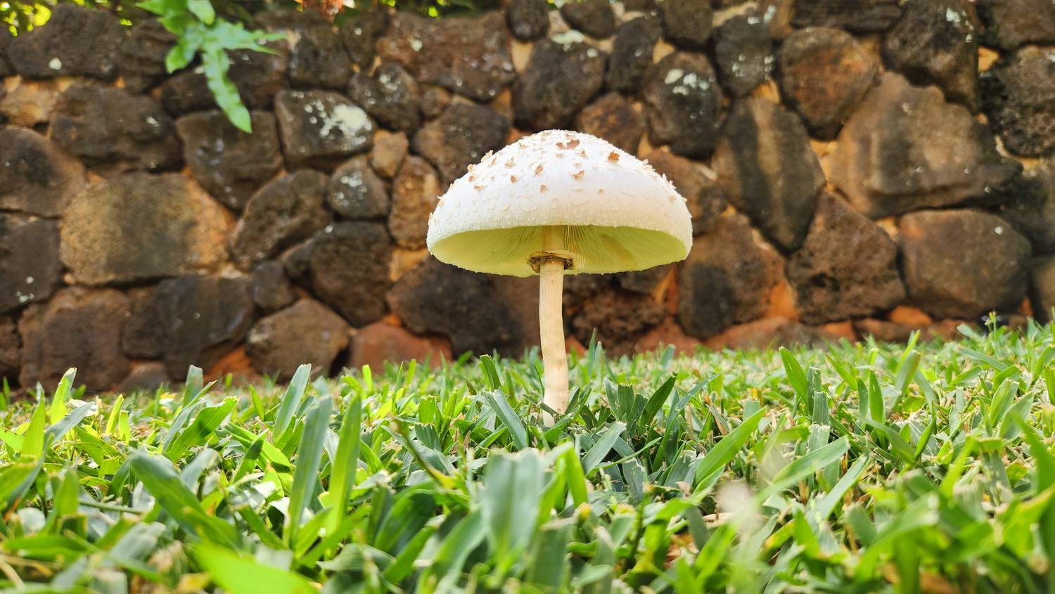
Spouting Horn is famous for its blowhole. The picture I kept from here is this little mushroom, standing in the grass by the lava-rock wall like it had its own spotlight.
Across the road, the valley of Lāwaʻi-kai passed from Queen Emma to a sugar family to a Chicago heir. Today it is a garden you visit with a ticket.
Spouting Horn quick facts
How it works
Waves push into a lava tube under the shelf and force water up through a narrow hole. The spray can reach 50 feet.
The sound
The hiss and roar is air being squeezed through cracks in the rock.
The legend
A giant moʻo (lizard) named Kaikapu guarded this coast and ate anyone who fished or swam here. A boy named Liko jammed a stick in her mouth, swam under the lava shelf, and escaped through a small hole. Kaikapu followed and got stuck. The roar is her.
Across the road
The National Tropical Botanical Garden’s visitor center, where tours of Allerton and McBryde Gardens start.
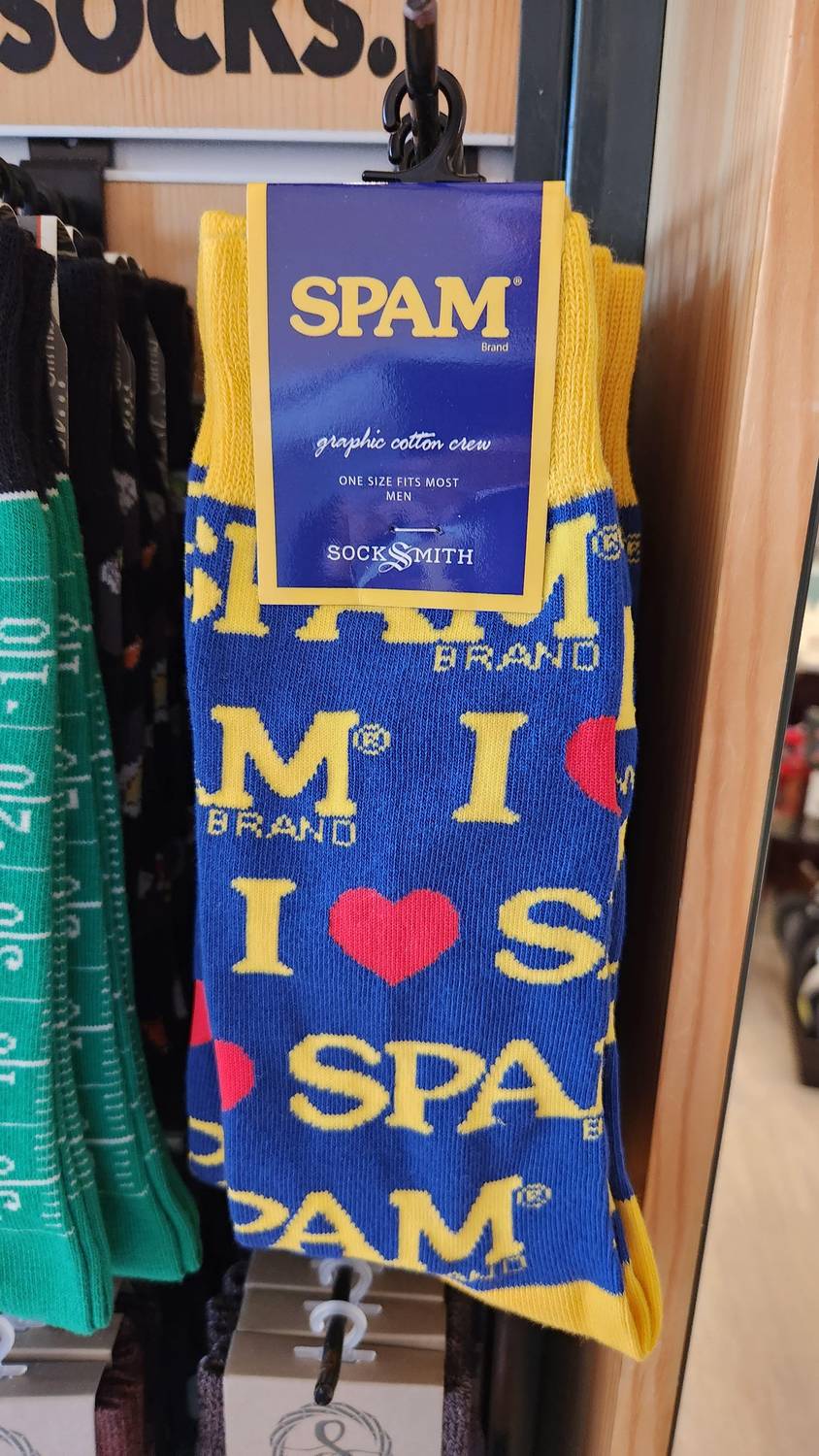
Souvenir shopping in Poʻipū. Hawaiʻi takes its SPAM seriously, and there’s a real history behind it.
It came with the military in World War II. SPAM stuck around, and so did the military.
Why Hawaiʻi loves SPAM
Born
1937, in Minnesota, from Hormel Foods, as cheap protein that didn’t need a refrigerator.
The war
During World War II the U.S. military bought more than 100 million pounds and shipped it across the Pacific. With fresh meat hard to come by in the islands, it stuck.
Today
Hawaiʻi eats more SPAM per person than any other state, about 7 million cans a year.
Try
SPAM musubi: a slice of grilled SPAM on a block of rice, wrapped in nori. Every convenience store has them.
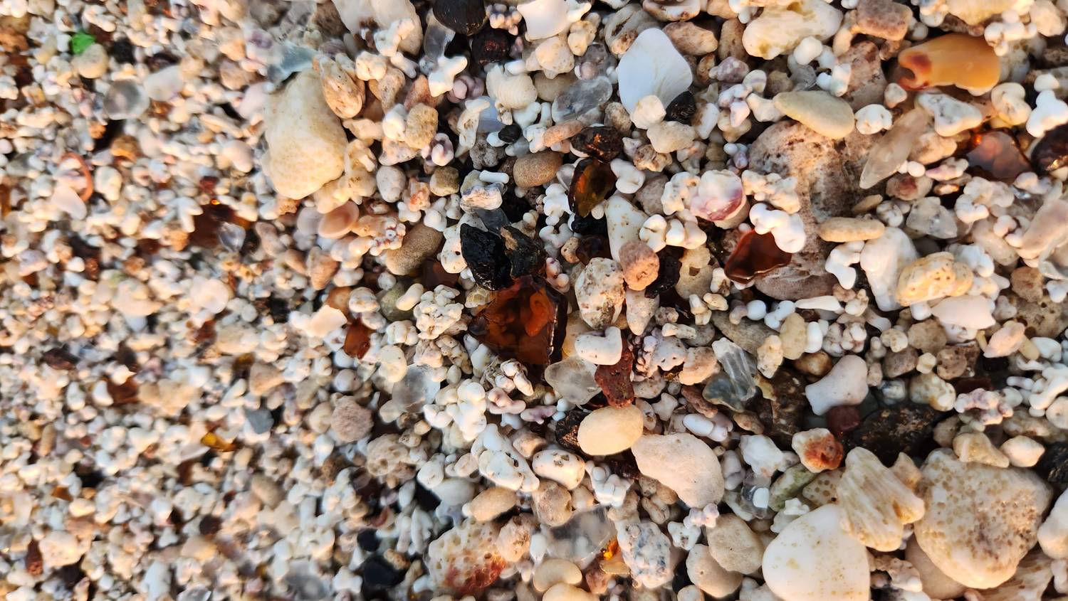
Get down close at Glass Beach and the “sand” turns out to be mostly other things.
Up on the bluff, the old McBryde Sugar plantation cemetery looks down on what used to be the dump.
What’s in the sand
Brown glass
Most likely from old bottles, rounded and frosted by decades in the surf.
Clear glass
Frosted until it looks like little pieces of ice.
Green glass
Keep looking and you can find aqua and blue, too.
Dark rock
Most likely basalt, the volcanic rock the whole island is built from.
White, knobby bits
Most likely broken coral, a big part of any Hawaiian white-sand beach.
Pink-edged pieces
Seashell.
Glass Beach quick facts
Where
In ʻEleʻele, next to Port Allen Harbor on Hanapēpē Bay, in the middle of an industrial area. That’s part of the charm.
Where the glass came from
For much of the 20th century people dumped trash here, including bottles and car glass. The ocean did the rest, tumbling it into smooth, frosted pebbles.
Please leave it
There’s less glass every year, and what’s left is getting smaller, because decades of visitors have taken it home as souvenirs.
On the bluff above
The old McBryde Sugar plantation cemetery.
A cousin in California
Fort Bragg, on California’s North Coast, has a Glass Beach with the same kind of backstory.
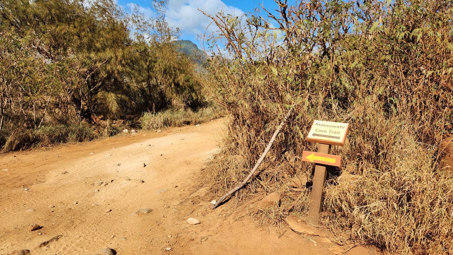
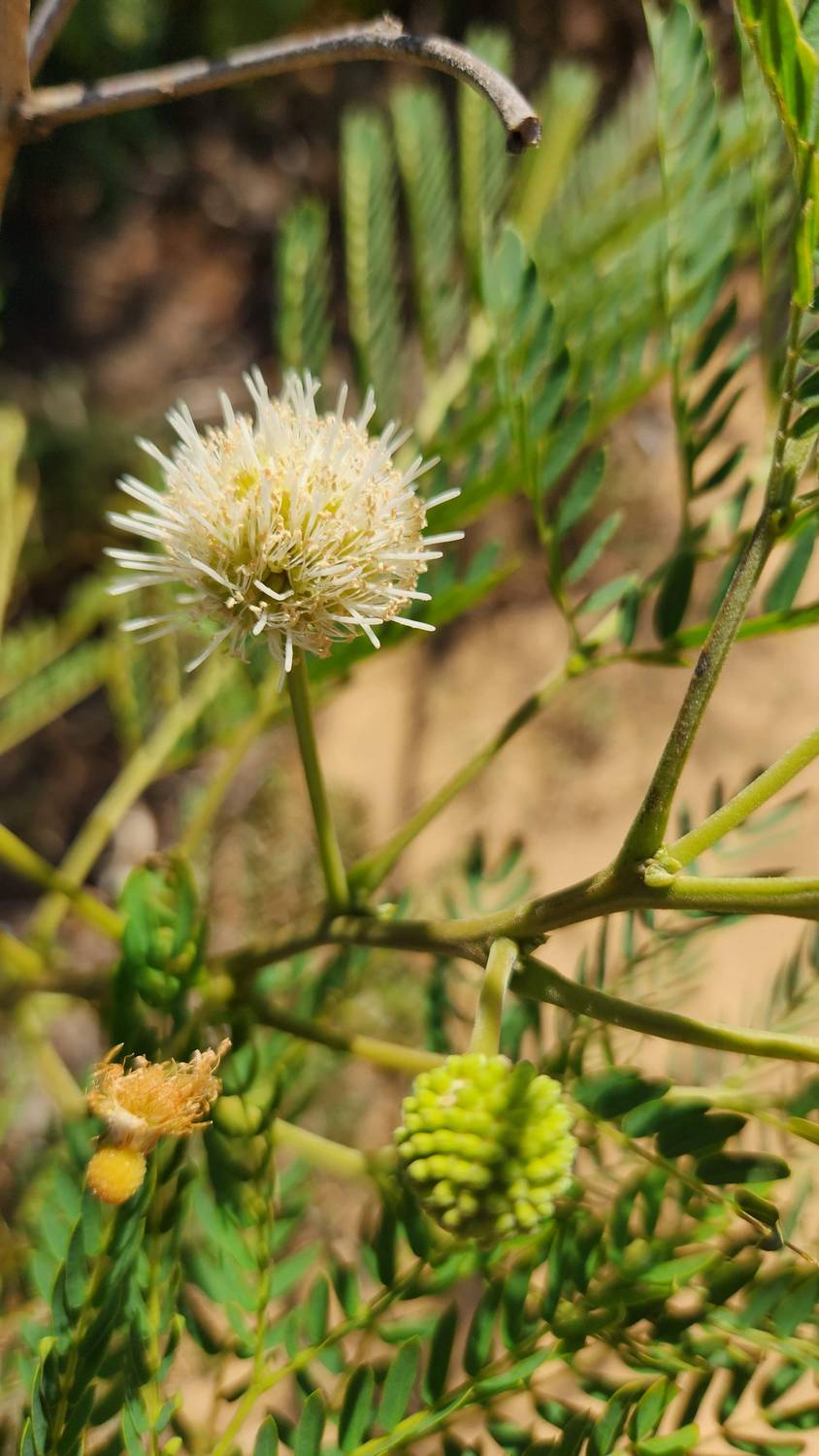
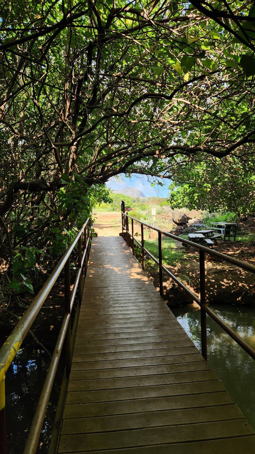
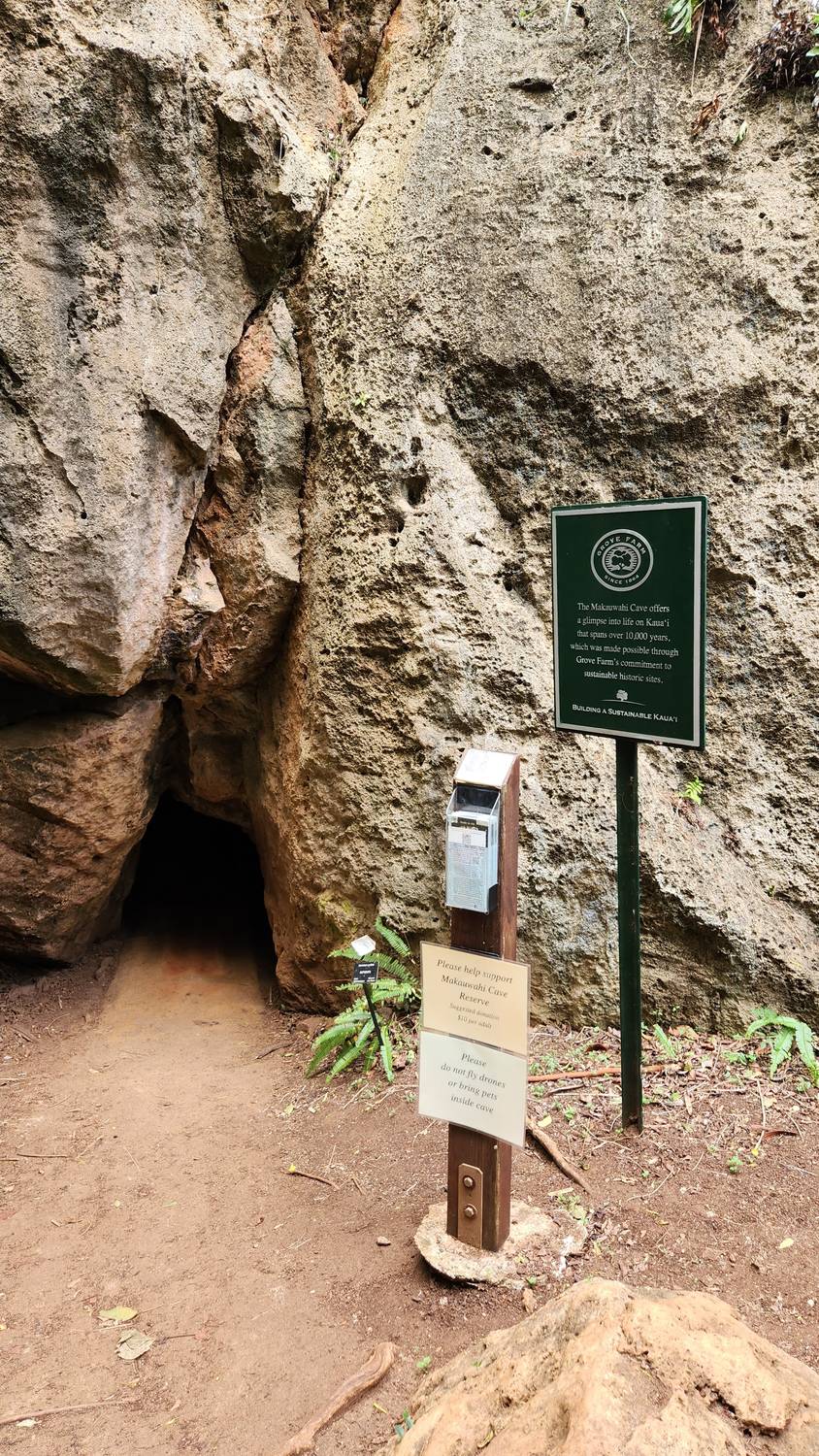
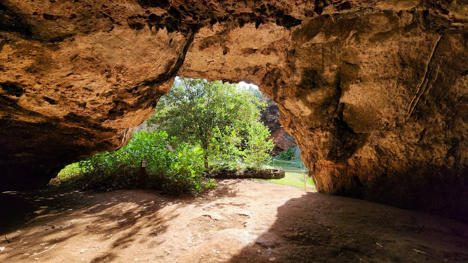
Red dirt roads and little yellow arrows.Haole koa, “foreign koa.” Pretty, and on the list of the world’s 100 worst invasive species.A boardwalk over the wet ground near the cave.The front door, lower left, about three feet tall. A little more crawl than I would have liked after the hike.Then it opens up, and daylight pours in from the sinkhole.
1 of 5
Over the hill and into the cave
This one took some work: a hike over the hill, red dirt roads, and then a crawl. Worth every step. Swipe through the walk in.
A private company decides who may enter a cave holding 10,000 years of Hawaiian history. In 2024 it closed the doors. People pushed back, and the company promised to open them again.
Makauwahi Cave quick facts
What it is
The largest limestone cave in Hawaiʻi, and maybe the richest fossil site in all the Hawaiian Islands.
The name
Makauwahi means “smoke eye.” The old name was rediscovered in 2000.
The rock
Not lava. The cliffs along this coast are ancient sand dunes, blown in during the Ice Age and cemented into limestone.
Who found it
In 1992 David Burney and Lida Pigott Burney, with bird researchers Helen James and Storrs Olson, found the sinkhole while searching the south coast for fossil sites.
The reserve
About 17 acres, on land owned by Grove Farm, a company built from three former sugar plantations. Grove Farm’s sign at the entrance calls the cave “a glimpse into life on Kauaʻi that spans over 10,000 years.”
Visiting now
In 2022 there were free docent tours with a suggested $10 donation. The reserve closed on October 31, 2024 when its lease wasn’t renewed. After a public outcry, Grove Farm handed stewardship back to the nonprofit reserve and promised to reopen it, with the cavern itself open by appointment for school, science, and cultural groups. Check cavereserve.org before you go.
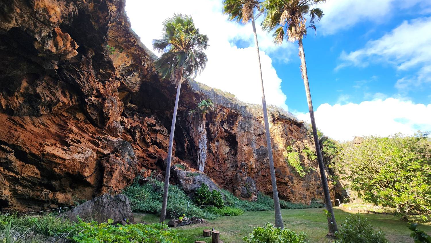
Out the far side of the cave, you step into an open-air room with walls on every side. The overhang on the left is what’s left of the old cave roof.
What’s under the floor
About 7,000 years ago
As the sea rose, a large part of the cave ceiling collapsed and opened this room to the sky. It became a small lake that caught whatever fell in.
The fossil bed
Researchers dug about 33 feet down through nearly 10,000 years of layered mud. They found bones of more than 40 bird species, about half now extinct, including giant flightless ducks and a long-legged owl.
About AD 1200
Chicken bones, rat teeth, and charcoal appear: the first signs of people on this stretch of coast.
400 to 500 years ago
A huge tsunami threw boulders of up to 200 pounds into the sinkhole and sealed the older layers underneath.
Today
The reserve keeps African sulcata tortoises as stand-ins for the extinct flightless ducks, grazing the way those birds once did, and is replanting native palms and flowering plants.
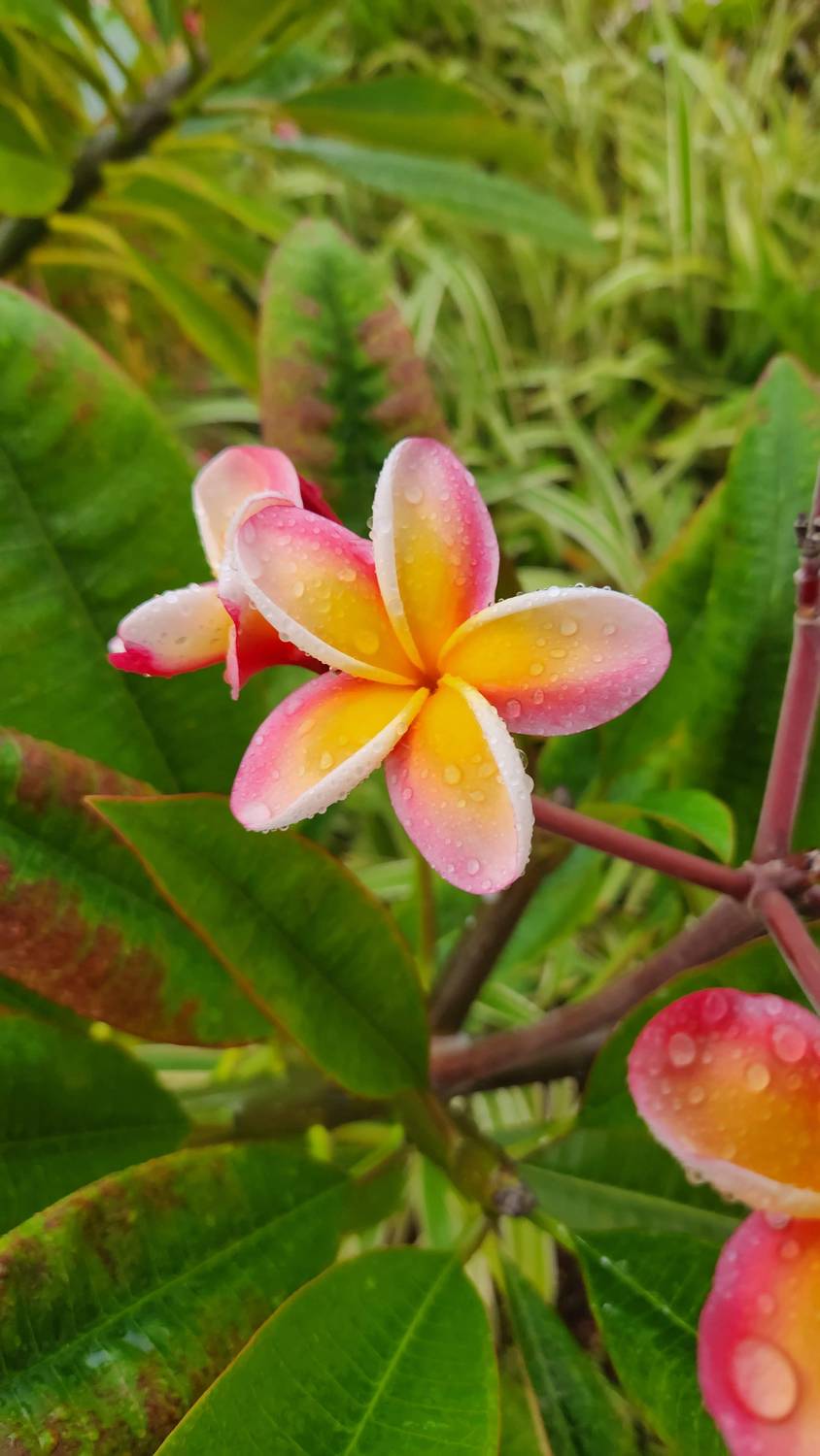
An early shower had just passed, and the plumeria outside the hotel was covered in drops.
The man who brought the first plumeria, William Hillebrand, also brought workers: in 1865 he returned from China with more than 500 contract laborers for the plantations.
Plumeria quick facts
Not native
Plumeria comes from Mexico, Central America, and Venezuela.
Here since
1860, when the German physician William Hillebrand brought in the first one, the Common Yellow.
Still
It became one of the best-loved lei flowers in the islands.
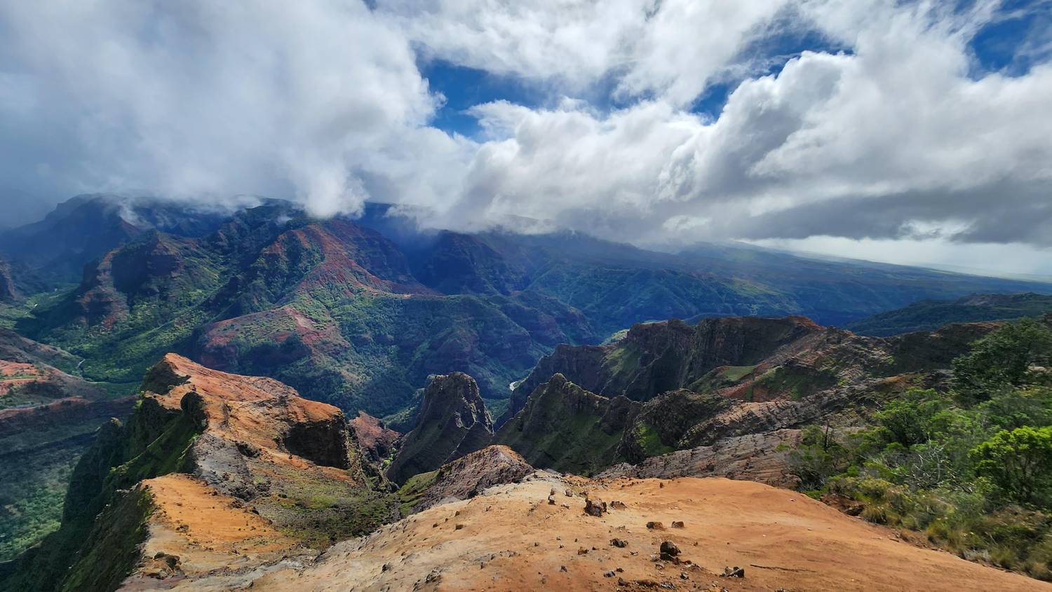
Red rock, green slopes, and clouds sitting right on the rim. It’s the same island as Hanalei, and it looks like a different planet. Compare them yourself below.
Cook’s ships anchored at the mouth of this canyon’s river in 1778, and they brought disease. By 1890, a Hawaiian population once estimated at 300,000 or more had fallen below 40,000.
Waimea Canyon quick facts
Size
About 10 miles long and up to 3,000 feet deep. Some sources say more than 3,600.
How it formed
About 4 million years ago part of Kauaʻi’s shield volcano collapsed. The Waimea River, fed by rain off Waiʻaleʻale, has been carving along that break ever since.
Why it’s red
The lava started out black. Weathering turned the exposed basalt rust red. Waimea means “reddish water.”
Getting there
Highway 550 climbs 18 miles from Waimea town, where Cook landed in 1778, past the lookouts to Kōkeʻe State Park. The state park covers 1,866 acres.
↔️Interactive photo. Drag the handle (or use the arrow keys) to swap between the wet North Shore and the dry west side.
↔
WET: HanaleiDRY: Waimea
Wet side, dry side
These two photos were taken about 15 miles apart. The difference is one mountain. Trade winds carry moist air in from the northeast and push it up over Waiʻaleʻale, where it cools and rains. By the time the air comes down the far side, it has been wrung out.
~374 inaverage rain per year on Mount Waiʻaleʻale, one of the wettest spots on Earth. The record is 683 inches, in 1982.
~20 inaverage rain per year on the west side, around Waimea and Kekaha.
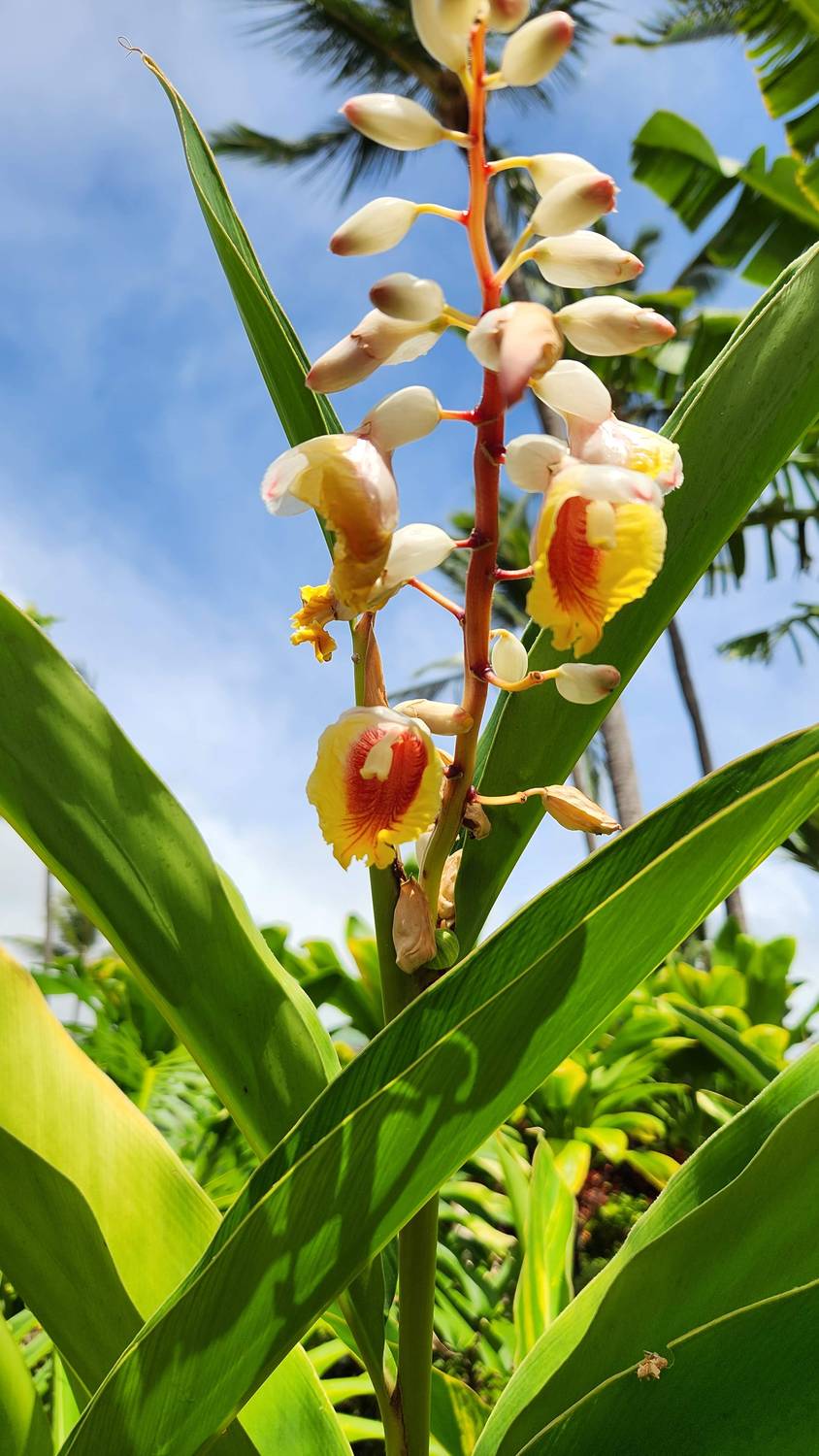
Back at the hotel after the canyon. The buds really do look like little seashells.
Shell ginger quick facts
Name
Alpinia zerumbet. “Shell” comes from the pink-tipped buds.
From
East Asia: northeast India and Myanmar through China to Japan.
In Hawaiʻi
It has gone wild on Kauaʻi, Oʻahu, Molokaʻi, and Maui and is rated high-risk for invasiveness. Beautiful in a hotel garden, not so great in a native forest.
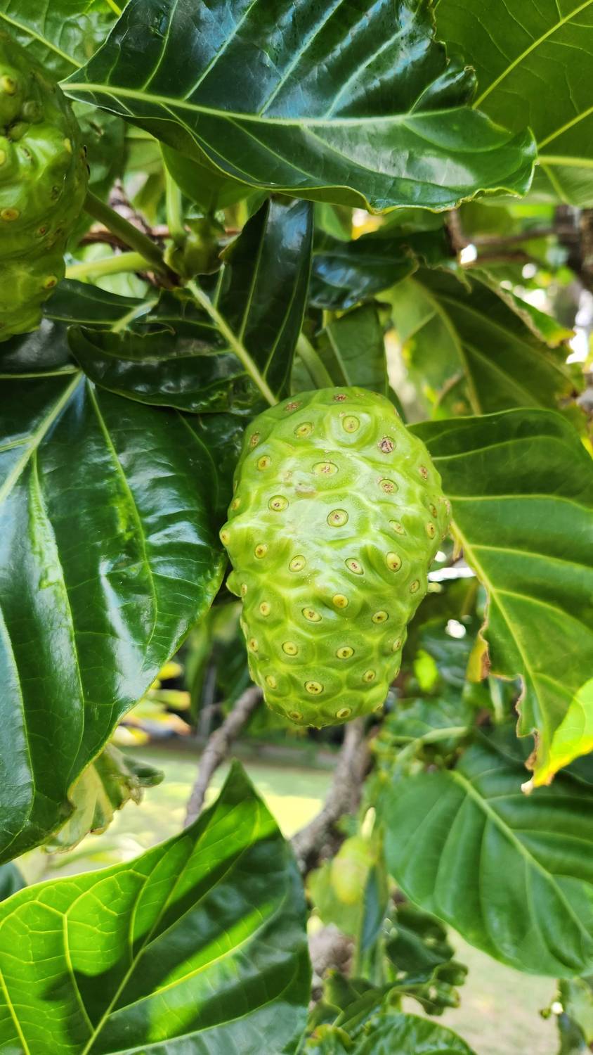
One last look at the North Shore, and a lumpy fruit hanging right at eye level.
After the 2018 floods, the Hāʻena community helped remake the state park here: reservations, a cap of 900 visitors a day, and local stewards running the gate.
Noni quick facts
A canoe plant
One of the plants Polynesian voyagers carried to Hawaiʻi on purpose. It’s the only canoe plant grown mainly for medicine.
Uses
Leaves and fruit for wounds, bruises, and sores. Roots and bark for yellow and red dye. Famine food when there was nothing else.
Fair warning
When the fruit ripens and turns white, it smells strongly, often compared to blue cheese.
Details checked September 2026. Access to Makauwahi Cave and the Hanalei viewpoint changes, so check before you go. Map elevation: AWS Terrain Tiles (Mapzen / USGS).